The Museum am Rothenbaum (MARKK) in Hamburg keeps an impressive collection of maps from East Asia, namely China, Japan and Korea. Currently the maps are being examined in a three-year joint research project "Coloured Maps" (2018–2021), funded by the German Federal Ministry of Education and Research (BMBF), the Centre for the Study of Manuscript Cultures and the Mineralogical Museum, Center of Natural History (CeNak) (both University of Hamburg), the Hanseatic Business Archive Foundation and the Museum am Rothenbaum in Hamburg. Applying methods from the material sciences and with art- and cultural-historical approaches, the research group analyses hand-drawn and hand-coloured maps from European and East Asian areas, produced between the fifteenth and twentieth centuries. Our research focuses on the function of color, technical aspects and color production, but also on the historio-cultural classification of selected maps.
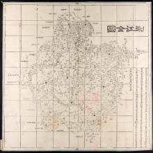
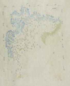
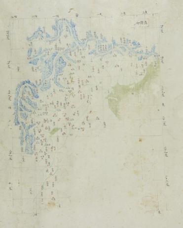
Within the group I conduct research on the maps kept in stock in the Museum am Rothenbaum. Amongst others I am examining closely a more than ten-metre-long scroll with 25 hand-drawn maps of China and tributary state. The scroll is entitled Tianxia yutu: (Map of the World). The maps’ style and the characteristics of the longitude lines suggest that the maps belong to the "Qing Atlas tradition." The purpose of my research is to date the map, to classify it in this tradition and to explore the circumstances of its origin and usage.
Province Zhili, one of the maps on the scroll. Museum am Rothenbaum Hamburg (640:07)