Various levels of the sea, situated anywhere between low and high tide, have been used throughout history as reference points in geodesy. Yet nowadays, the sea level is mentioned mainly within discourses about the effects of anthropogenic climate change. My research asks how and when this shift in attributed meaning occurred and, more generally, what the effect on scientific practices of such an appropriation and reframing of terminologies and metrics might be.
Notwithstanding its constant variability, the height of the sea was long considered the only reliable way to relate altitudes in non-contiguous stretches of land. A century and a half of scientific research on tides—from Newton to Whewell, via the adoption of a “mean high tide” as a point of reference in the Netherlands—led to the realization that an actual surface level could be represented only by a mean sea level. Central to its definition was the early nineteenth-century invention of the first self-registering tide gauges, which enabled the automated collection of precise data over the long periods of time required to yield usable averages.
The use of the mean sea level as a reference point for geodetic research, prospecting, and surveys was suggested as early as 1831 by John Augustus Lloyd during his work to ascertain the difference of level between London Bridge and Sheerness, and again, in the 1840s, by Astronomer Royal George Biddell Airy in respect to the planned trigonometrical survey of Ireland. From the mid-nineteenth century, several countries set up their own networks of standardized self-registering gauge points and started using their national mean sea levels as geodetic datums.
The mean sea level is an eminently social construct, created in the search for a point of reference in a littoral space that, as Rachel Carson reminds us in The Edge of the Sea (1955), is never at rest. The definition of a mean sea level is an attempt to set a standard by statistical means, creating a virtual boundary between land and sea—yet this reference point remains elusive because, being an average, it is no more than a representation of the constantly mutating coastal edge. Geodetic datums have now become almost completely detached from changes in the sea, and their constructedness is accepted: variations in the actual sea level no longer determine the measurement of heights.
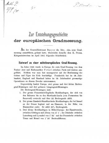
Johann Jacob Baeyer, Zur Entstehungsgeschichte der europäischen Gradmessung. Berlin: Stankiewicz, 1862, p.1; Münchener DigitalisierungsZentrum.
The link between mean sea level, arc measurement, and trigonometrical altimetry was stressed at the 1864 and 1867 conferences during which the Mitteleuropäische Gradmessungs-Kommission—the predecessor of the current International Union of Geodesy and Geophysics—was formed. This intergovernmental association was born from a proposal by the Prussian military surveyor Johann Jakob Baeyer to initiate the exact measurement of degrees of latitude and longitude across Central Europe; it then developed into a truly global endeavor. One side effect of the research it promoted was the persistent, if unsuccessful, attempt to define a Europe-wide (and later worldwide) standard reference point for height measurements. When the commission was established, it was presumed that all seas encircling Europe shared the same surface level, and hopes were high that a common reference point could easily be determined. On comparing the new, more precise national measurements, however, differences between national geodetic datums became apparent that could not be attributed to errors in the leveling process. Despite a lengthy debate, by the end of the nineteenth century the only viable solution found was to maintain the national points of reference and name their discrepancies when performing international comparisons or scientific studies. That solution was reaffirmed in the late 1920s. In the 1990s, within the European Vertical Reference System, the Amsterdam Ordnance Datum was arbitrarily chosen as the Europe-wide geodetic datum. Even if the hunt for a global point zero of altitude was deemed a failure, it was instrumental in the reevaluation of assumptions that all Europe’s seas were part of the same surface level and the creation of a reliable network for future measurements.
Mean sea level did not remain confined to the realm of geodesy, but has been appropriated as a metric of anthropogenic environmental change. This movement exemplifies processes in the history of metrics of change—the adoption, standardization, and deployment of which lie at the core of my wider research project historicizing the terms and baselines used in current analyses of the Anthropocene. I am interested in how these concepts originated within cultural, social, and scientific frameworks radically different from today’s. Past apprehensions of the environment still inform its understanding, even within new and completely different disciplinary settings.
Given that global climate change as we understand it today has not been an issue for most of human history, it is no surprise that the shift of the idea of mean sea level from geodesy to climate debates is quite recent. Negligible increases in recorded mean sea levels in the nineteenth century, had they even been noticed at the time, would probably not have suggested any link between climate and sea level, even less a debate about anthropogenic environmental change. Nonetheless, research that considered changes in mean sea level independently of the search for a geodetical point zero was already common in the nineteenth century, much of it linked to contemporary debates on the ice age theory. When sea level changes were noticed, they were usually attributed to coastal subsidence, which by the mid-nineteenth century was estimated at around 2 feet per century. Only in 1948 do we find the first reference to the difference between absolute subsidence (land sinking) and relative subsidence (sea level rise) and the first invitation to analyze sea level changes worldwide in these terms.

Johann Jakob Baeyer (1794–1885). Portrait by Paul Stankiewicz; Wikimedia Commons.
In more recent years, new methods of altitude measurement, the rise of satellite navigation systems, and public debates about climate-induced sea level rise have led to further changes in the analysis of the mean sea level and its significance. Those changes will be studied further on in my project. What is already clear is that even if the perception of the mean sea level’s role in environmental change is a recent phenomenon, it has deep historical roots, which my research aims to uncover in order to deepen our understanding of the Anthropocene. Attending to the social construction of scientific judgments and standards, and the ways that changes have been apprehended over time, this project fits squarely into the Art of Judgment working group, which I coordinate within the “History of Planning” theme in Department III.